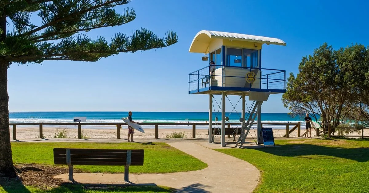
This year I convinced some good friends to join Emily and myself as the Resultz Racing team to do the Geoquest Half – a 24-hour supported adventure race. The location was Sawtell on the northern NSW coast, and as it was the start of Canberra’s winter it wasn’t hard to find more friends to be our support crew for the race, especially when we sold it as an all-expenses-paid holiday with just a few jobs to do...!
The team consisted ofGordon, Kieran, Emily andmyself. Emily had done a24-hour adventure racewith me a couple of yearsago (Wildside), but Gordonand Kieran hadn’t doneanything more thanmountain bike races, andthe support crew (James,Laura and Erin) weresimilarly unfamiliar with thechallenges of Geoquest, sowe did a lot of planning andtraining in the lead-up to the race. The team went on a number of long rides and hikes, regularly got wet and cold in the lake on one of the yellow AROC “toy boy” sit-on-top kayaks (thanks Tom and Alina!) and generally tested our limits with new challenges. We even spent an hour learning the technicalities of using a bow and arrow (thanks Neil!) after learning the mystery discipline this year would be archery. Of course it wasn’t all hard work – for instance, most hikes or rides near Mount Ainslie finished with a schnitty and pint at Edgar’sJ
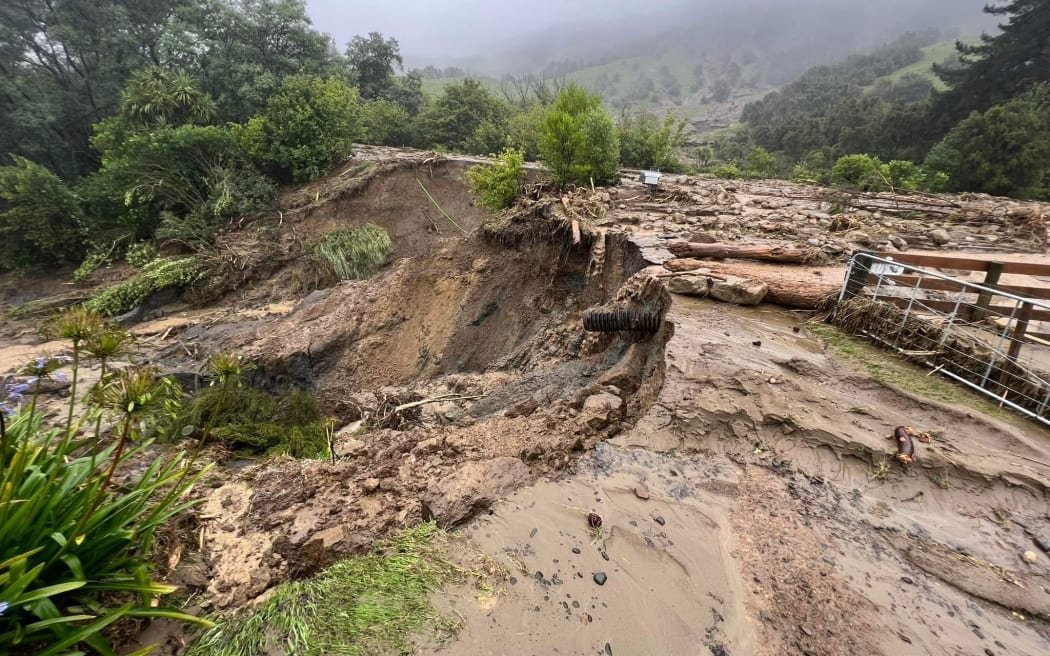
As we got closer to the race weekend it became apparent that the lovely warm weather we had been hoping for was going to be clobbered by major rain from the south, with the forecast rainfall for Saturday increasing at each update – first 15-25mm, then 35-60mm, then 50-90mm with localised falls reaching as much as 200mm! On the morning of the race it seemed the blob on the weather radar was doing its best to cover the entire course... but let’s get back to the fun of preparing for an adventure race.
The team jumped into two cars early on Thursday morning to start the road trip to Sawtell, loaded up with all the gear required to undertake Geoquest – hiking and paddling gear, bikes, lights, and lots of clothing. Being a weekday the roads weren’t too bad, so just after dark we unpacked into our awesome accommodation, which had a double garage, two lounges, and lots of rooms and beds – perfect for seven people to conduct an adventure race. Unfortunately for Erin the weather wasn’t very conducive to lazing on the beach, with the rain starting on Friday morning and not really stopping until Tuesday the next week...
Race registration was at the Sawtell Surf Lifesaving Club from midday, followed by race briefing and map handout at 3pm (indoors due to the weather). The race briefing this year included a reroute of the course due to the risk of flash flooding
of the Bellingen River – the Geo Half would have no paddling at all, and the Geo Full might have a short ocean paddle to start, unless the weather worsened.
So the race for us had been reduced to a 13km beach trek, a 38km bike leg with 1000m of climbing, a 16km trek with the same amount of climbing, a shortened 22km bike leg to bypass the dropped kayak leg, and a final 14km beach trek to the finish. The fact it was raining wouldn’t greatly affect how wet we were going to get, as there was a short estuary swim at both the beginning and the end of the race anyway. I was just glad that the temperature was so much warmer than Canberra!
The rest of the afternoon and evening was spent preparing bikes, backpacks, maps and gearboxes, with a number of dry bags applied to important gear, and the next morning it was still drizzling steadily when we woke up and packed the cars. Race start was just down the road on the beach inside Coffs Harbour itself, so we joined the other damp racers hiding under the picnic shelters to get our mandatory phone sealed up and receive our tracker. After a short welcome from Craig the race director we all shuffled down to the beach and stood behind the line scraped in the sand (it was a fairly subdued race start compared to previous years for obvious reasons), and then it was time to race!
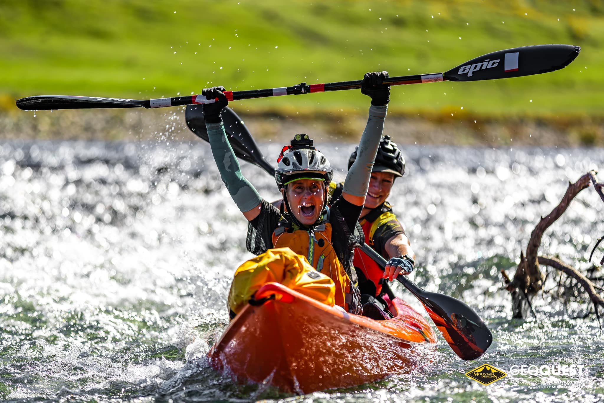
At 8am we headed north with the rest of the Geo Half field, tracking along the beach, through the estuary and flooded creeks, and over headlands. At one stage we saw lightning in the distance and were pelted with heavy rain – little did we know that the Full course had started in the harbour an hour after us, and they were struggling to stay in theirkayaks in the strong surf.They were supposed to dothree loops inside the harbourbut the lightning andconditions resulted in thisbeing cancelled shortly afterstarting. The spectators andphotographers who bravedthe weather were treated tosome amazing sights, such aspaddlers being dumped from their boats and incoming kayaks being speared into the sand – apparently one kayak even folded in half!
Oblivious to this carnage, we continued our trek north in the soft sand. We avoided running in order to ensure Gordon’s recurring ITB issue didn’t flare up, and a number of teams around us had the same idea. I chatted to a few other teams and most were like us – first time Geo racers just aiming to get through the distance.
Eventually we reached the firsttransition area (TA) and met oursupport crew. Laura looked afterour gear and bladders, Jamesprepared the bikes, and Erin fedus hot fish and chips (yum!)while we changed into dry ridinggear – we were being optimisticabout the weather. I changedmaps and it was back onto thecourse, heading into the hills west of Moonee Beach.
We made pretty good time up the sealed section, overtaking a few teams who had struggling riders or were changing flat tires (bugger!) before reaching the next checkpoint at the top. After this we followed a fairly flat fireroad then turned onto a steady downhill trail with water bars, which Kieran proceeded to attack with gusto.
At this point I should recount the cause of two teams having to retire within the first 24 hours of XPD last year – riders not taking care on downhill fireroads and ending up in hospital. I watched in awe as Kieran got huge air off the first water bar in front of me, which turned to shock while he rode his front wheel down the hill, then his rear wheel followed through and dumped him headfirst onto the middle of the muddy track with a solid “thump”. At first we just got a groan out of him, then we spotted blood coming from a wound on his nose, and his left shin wasn’t much better. Fortunately Emily had just completed a wilderness first aid course with the ACT rogaining association, so she was able to assess and patch up Kieran fairly quickly. Despite the severity of the crash he was able to continue on ten minutes later, albeit at a more sedate pace, and somehow his bike survived unscathed.
The next section introduced us to mud and flooded creeks, which became a common sight during the off-road segments of the rest of the race. We followed
a straight fence line towards the checkpoint, but these are just like power lines – the trail went up and down continually. I tried to match the creek crossings and trail junctions with the map, but it quickly became evident that recent logging had resulted in a trail network that only vaguely resembled the map. We found “elephant tracks” from previous teams hunting in different creek
lines before eventually stumbling on the cunningly hidden checkpoint. Sadly we also saw a number of teams splitting up, with most team members waiting at the track junction while someone went back with the control card.From here it was a longclimb then a fast descentto get through somebeautiful rain forest andonto the bitumen, wherewe met the ever cheerfulLinda and Suwati at thebus stop checkpoint.They checked overEmily’s repairs of Kieranand took some photos ofus, and then we were off.This proved to be ourstrength – with Emily onthe tow-line we madegreat time and overtook a number of teams struggling up the many climbs.
The last few kilometres of this leg required us to climb out of one valley and drop into the next. The climb wasn’t so bad, but the track got narrower and steeper
on the descent until we were more sliding than riding down. Then the track dropped away even more, so we joined the other teams walking their bikes. During the descent Emily had fallen behind and I suspected she had chosen the safe option of walking, but instead she was right behind Gordon! She admitted later that she was focused on the upcoming TA and didn’t really think about the dangerJ
After more slipping and sliding (and passing fellow Canberrans the GeoVikings who had apparently done a bit more climbing than necessary!) we finally reached the road at the bottom and rolled into the TA during the only patch of almost-sunshine in the race, and found our super amazing support crew had procured pizza and roast chicken for us!
Sadly the beer pictured was withheld until the end of the race...
Prior to the race we had decided to name our TAs based on the food our support crew would be supplying, so this was PizzaTAJ
We spent a bit of time here eating and getting changed into trek gear, as well as checking again on Kieran’s wounds and removing leaches, before hitting the road again and returning to the muddy hills. I tried to find a track that the map indicated would avoid the main peak, but as I had feared it wasn’t there anymore (Geoquest maps are
notoriously accurate and current), which was a lesson that many teams learned that day based on their GPS tracks. So we backtracked a kilometre and climbed the hill we had just come down on the bikes – a gentle 250m of climbing up mud then rock!
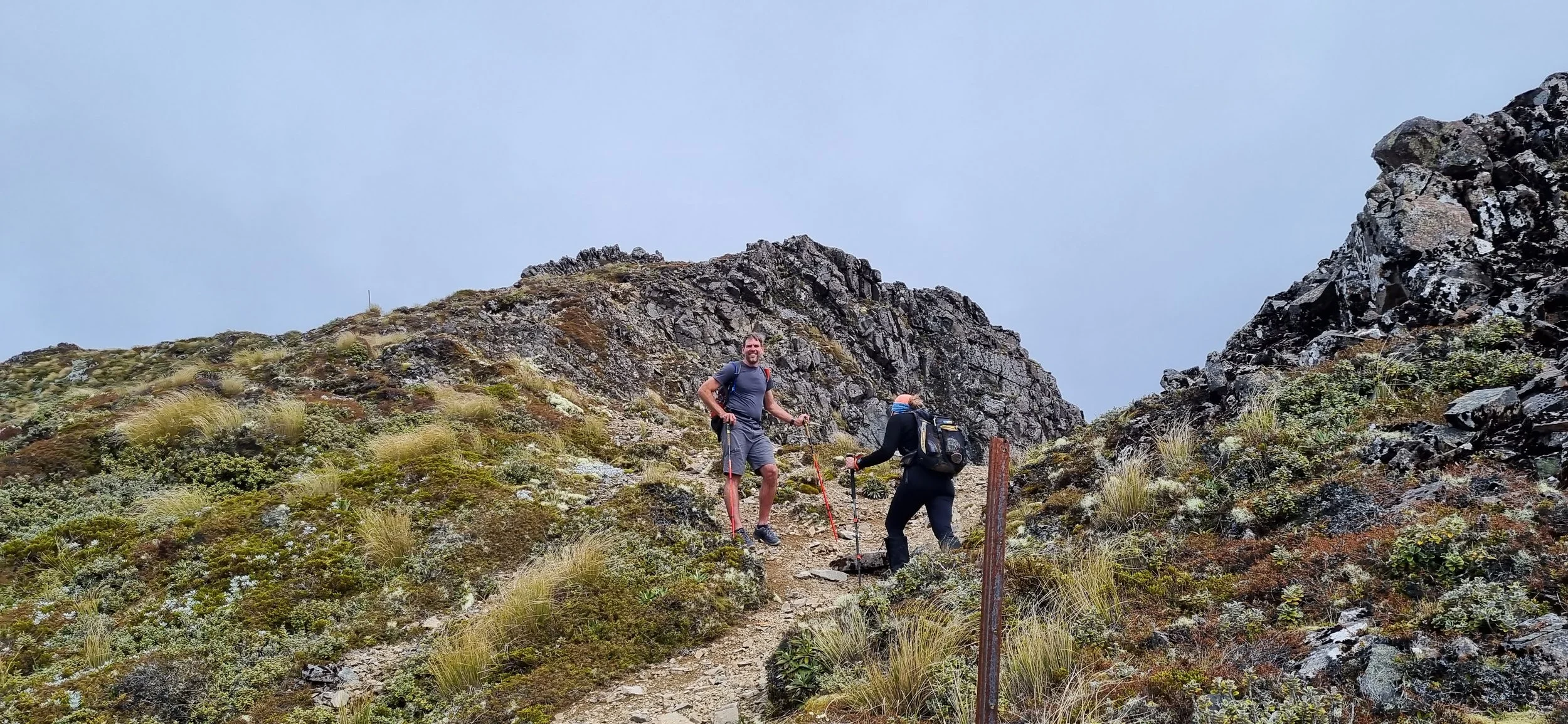
At the top it was time for lights,then we headed off into the hillsof the Orara West State Forest. Isuspect it would have beenpretty during the day, but atnight we just trudged alongtrails in a small patch of light,counting off the kilometres inour quest for three wholecheckpoints. A few routechoices, more checkpoints, orfewer kilometres would havebeen nice... This is probably where Gordon’s book of Dad Jokes would have come in handy, but he didn’t find a waterproof one in time.
I had a few issues getting back in contact with the map during this section – the change to night had thrown my bearings, and the change in pace didn’t help, but I also didn’t trust how the trails were marked on the map. We kept moving forward and eventually found the first checkpoint in a creek, shortly after being overtaken by the first two Full course teams (we had seen them bombing down the hill as we hiked up from the previous TA). Just then the heavens opened again, so we put our raincoats on and got back on the trail, now looking a bit like
Gandalf and his hobbits with our hiking sticks. We copped a few derogatory remarks from the Full course teams when they saw us, but I reckon stability in the mud is much more important than fashion in an adventure race!
The renewed rain made the trail even more treacherous, so when we embarked on the 200m descent of Saddle Trail to the next checkpoint our speed dropped
considerably. The grip on our shoes had filled with mud and we didn’t feel like sliding down the goop on our bums like passing teams did, plus there was the risk of Gordon’s ITBs flaring up. To
overcome this he developed a sideways
crab walk that was actually quite fast!
Eventually we reached the bottom andled a couple of teams to the nextcheckpoint at a creek crossing. Westopped here and ate the yummy roastchicken sandwiches prepared by oursupport crew. I considered taking us upa side track to see if it would join upwith our destination trail, cutting offabout 1.5kms of extra trekking, but after the previous missing track debacle we decided against it – it turns out a couple of teams took the plunge and found an open fireroad that took them all the way to the top!
The final four dirt kilometres of this leg were brutal – a 300m climb to a peak almost as high as Canberra, then a 450m descent! We had hoped to find a more gradual descent but sadly the map didn’t match the tracks.
When we arrived at CP18 (aka ManStewTA) it was only raining a bit, and James had gone pro-
support-crew by buying a (mostly) waterproof gazebo. Laura had also glammed him up with some glowsticks in his headlamp – classic! We fronted up to Linda’s archery challenge – hit the target just five times with a kiddies bow – simple after our training. Then it was back to our support crew for some of Gordon’s home
made man stew (I had my doubts but it was pretty delicious), into some fresh bike gear and onto the bikes for a short and flat 22km to Mylestom on the coast.
Shortly after departing the TA at midnight the forecast severe storm warning eventuated – we were riding through torrential rain, completely soaked through and barely able to see 20m ahead. If I was in a car I would have pulled over and waited for it to clear, but this was Geoquest so we forged on!
I had to wipe both my glasses and the mapboard to make sure we were going the right way, and focused the
rest of my attention on just staying on the road. I kept glancing back expecting to see the team pulling over but they stuck to my wheel like bedraggled glue, even calling out “go for it” when we caught a Full course team on a climb and I suggested overtaking them – I guess we all just wanted it to finishJ
A few wet and boggy kilometres later (it took us 1.5 hours but everyone agrees it felt like just 15 minutes as it was so surreal) we reached the little town of Mylestom. I mistakenly turned left at an intersection which cost us a minute or two, but that gave our support crew enough time to reach the ChickenToastieTA ahead of us with 30 seconds to spare.
Instead of pausing to get completely changed we just put running shoes on and grabbed some hot chicken toasties (thanks Erin!) before heading back to the beach and pushing for the finish line, a short 14km away.
The map showed a small trailrunning parallel to the beach forabout three kilometres – it waslined by spooky white trees butkept us protected from the winduntil we reached the BundagenHeadland. Then it was out ontothe beach for the final sevenkilometres to Sawtell. Unlike theprevious bike leg that went by ina flash, this beach hike seemed togo forever, with the distant lightsnever getting closer. We turnedour headlamps off and used the dim moonlight to see by, then Gordon tried walking with his eyes closed but couldn’t maintain a straight line.
The final challenge of the race was in the last kilometre – we had to cross the flooded Bonville Creek. Later teams arrived when the tide was higher and the outgoing flow was reduced, but for us it appeared impossible to not get washed out to sea or onto the rocks. We linked arms and waded out into the current, with Kieran taking the brunt of it and Gordon supporting him. Somehow we found a gravel section that gave good grip, and then the velocity subsided and we
reached the other side. At the time it seemed like just part of the adventure, but looking back afterwards it was actually quite dangerous – tired racers crossing floodwaters in the dark with minimal safety (just a couple of event marshals in a 4WD on the other side of the crossing). Fortunately we made it and reached the finish line just after, with our awesome support crew again arriving just in time to see us cross the line and present us with beers!
The finishing time was 4:58am – just short of 21 hours after we started! We came 26th out of 33 overall, and 15th in the Premier Mixed category, in a race that I think has set a new standard for “wet”.
At the end of it all, I reckon this was the most fun I’ve had at a Geoquest, even with the terrible weather and tail-end finish. Being able to introduce new people to the joys of adventure racing is pretty rewarding in its own right. Thanks to the rest of the team for joining me on such an epic adventure and being so strong, and special thanks to our amazing support crew who looked after us so well!