2005 - BONNY HILLS

Race Report from Team AROC Mountain Designs – Mountain Designs GeoQuest 2005

tm1.jpg

Team AROC which includes Tasmanians Matt Dalziel and Kris Clauson, recently won Australias biggest adventure race - the Geoquest. The winning team of the Geo Half, Shackleton's team, also sported 2 Tasmanians; Alexis Bull and Stuart McFadzean. 

This years Geoquest was held about halfway up Australia’s east coast near Port Macquarie at a place called Bonny Hill. As Australia’s premier adventure race the Geoquest draws together competitors from all around the country as well as a few brave Kiwis. The format is teams of 4, paddling, trekking and mtbing for 48hrs, with some tire tubing thrown in this year. The tubing proved to be a major focus of the race for many teams with a lot of designing and speculating before the race start. We first experimented with our tubes in Manly after jumping off the plane from Hobart (after it landed). However all we really learnt was that wrapping a tube in Glad Wrap and riding it kickboard style wasn’t gonna cut it. We ended up slapping a raft together on Friday morning before the briefing, and I must admit I was a little skeptical as to its prowess.

The race kicked off at 7:30 on Saturday morning with a paddle through the surf. Tom and I got swamped getting into the boat and then lost the hand pump that I had just got out to a breaking wave. With no chance of finding it we paddled on with a boat full of water with Tom making further contributions along the way. After the slow start to the paddle we jumped to 2nd when Landrover missed an obvious shortcut to the first checkpoint and then with the water emptied from our boats we flew past team Mountain Designs to finish the leg 1st.

We held our lead on the trek up the steep 400m North Brother before Landrover caught up to us on the way down to the tubing section. On the way down the mtn the anticipation of the subsequent tubing section inspired Matt into song - his now famous ‘Born to Tube’. It was this musical masterpiece that fuelled us through the tubing section in record time, helped or perhaps hindered by our sleek craft. By the end of the tubing were once again alone at the front with a lead we continued to build on slowly through out most of the race.

But the tubing didn’t end there, Oh no, we had to carry the rafts a full 7km back to headquarters! A leg we dubbed the ‘Death March’ as it felt like we were carry a casket.

Leg 2 started with an mtb along some really nice single track which in turn bought us to the swim. We waded and swam a few hundred meters across a lakey lagoon to fetch a boat which we then paddled back, loaded our bikes aboard and swam and paddled it back again. We then deposited our bikes and once again climbed aboard our trusty raft for the final tubing section. The thing that stuck in my nose from this leg is truly incredible smell emanating from Tom’s posterior. Unfortunately Tom was near the back of the raft and despite all its graceful waterlines, the slight tail breeze was still outdoing us. A short run down the beach saw us back at HQ for the Leg 3 which wasn’t revealed until we’d finished leg 2. This meant we had to mark up the maps in transition.

A long mtb started leg 3 and took us into the night, there were some very steep hills which were a struggle to even walk up. An unrestrained act of kindness saw us move a small friendly snake off the track so it wouldn’t be squashed by the rest of the field. The ride took us along some great cliffs with awesome views, but we couldn’t really see a great deal in the dark, just a few far off lights and the torchlight disappearing into the void below. A puncture on my behalf put a brief halt to proceedings. Then a section of tricky nav and we were at the start of the rogaine section.

Most of the checkpoints on the rogaine were pretty easy but one was a right pain in the ass. We had to bash along a creek looking for a junction but the problem was we couldn’t tell where the creek was, it kept disappearing and only made its presence known every now and then with a small soak in the otherwise flat and featureless terrain. The main highlight of the rogaine was however the abseil, a nice drop with a great view, except is was still dark for us. Once back to our bikes it was but a short ride back to HQ for the final leg of the race.

Leg 4 required support crews to drive teams about 60km to a drop where we’d start racing once again. With 1hrs timeout for the drive and 20mins compulsory rest before leaving we had thought we’d have a hot shower before we left. Sadly it was not to be as just getting ready to go took us the whole 20min. We enjoyed the drive though, first stuffing our faces with real food before slipping into a satiated slumber.

Leg 4 began with a 25km trek, a section which proved to be the most demanding of the race, mainly due to one very troublesome valley. We spend 2hrs making our way a mere 2km to 2 checkpoint located in the bottom of a gorge like valley. It would have been truly spectacular in the daylight, even in the dark its was quite impressive as we picked our way up down and around cliffs, up the creek and through the bush.

Daylight caught us near the bottom of a 500m descent of yet another big hill and nearing the end of the trek. With the end of the race in sight and a lead of about 2hrs we were starting to look forward to the finish. Another short 21km mtb saw us back into our kayaks for the 2nd and last paddling leg. The boats felt so fast! We must’ve become accustomed to paddling tire tubes because these things felt like rockets. We paddled hard for the first hour or so before we calmed down a bit, just in time for a checkpoint and a very convenient portage. A bit of shallow water after the portage almost became our undoing as Alina played princess and insisted on being carried across the sandbar while Tom then wanted to paddle the boat like a surfboard. Luckily Alina kept the whip cracking and we were soon all back in line steaming toward the finish once more.

A rather relaxed transition saw us into the last 7km run and the last section of the race. At the final checkpoint I was finally relieved of the stressful job of carrying the control card. We enjoyed all the beach scenery as we approached the finish line. Our finishing time was somewhere around 29hours. The occasion was such that Matt almost broke into song once more, but was struck down by a dash of stage fright. So it was hot showers and a team sleep before lashing out for a night on the town.

Matt did find his voice in the presentation the following day and treated the crowd to a heartfelt rendition of ‘Born to Tube’. The video will be on sale soon.


Kris Clauson

Race Report from Team Bozones – Mountain Designs Geo-Half 2005

tm105.jpg

Our first taste of kayaking through the surf was during the competency checks and whatever spare time we had on the Friday before the event. We had plenty of practice in water entry to the inflatables as the surf took its toll of us, both going out and coming in. I was knackered after Friday’s competency checks and that night I had little sleep listening to the pounding surf and thinking of what tomorrow would throw at us.

The 7.00am start, and the vast number of competitors lined up for the start, was a memorable experience. We managed to get through the surf OK but we had difficulty on the trip south with one boat being difficult to steer. We stopped a number of times (bobbing around in the middle of the ocean) and changed crew from one boat to the other to ease the strain. We were the last of all the kayaks to line up for the big swell and charge through the break wall at Camden Haven. Last Geo half boat in but our time of around 2hrs was better than expected.

Onto the 8km trek up North Brother, a good steady climb, we had to give way to many teams as they were running down from the checkpoint at the top. There were still a few teams with us which made us feel a bit better, we then jogged down the mountain side.

Just as we were slowing to check our map, Danny slipped on the only stone on the track and rolled his ankle. It did not look good, Danny strapped his ankle and popped a pain killer and then proceeded to slide on his backside down the mountain to the next transition on Queens Lake.

We got to Queens Lake with only one team behind us, still in it, then on to the tube raft for the 3km crossing of the lake. We could see around 7 teams on the water so we were off after a quick change. We made it to half way across the Lake in 45 min then we ran out of steam, the wind came up and everything seemed to slow us. We managed to pass two teams but it had taken over two hours to do the crossing. I could hardly walk when I hopped out to get the checkpoint.

We then carried our raft 7km back to Bonny Hills with Danny limping all the way and in some pain. We took over two hours to do the trek and on the way we saw several of the leading full geo teams heading out on to Leg 3 and we had not finished Leg one. We arrived back at the start after eight hours.

We were all ready to keep going and the strapping on Danny’s ankle was holding up. We set out on the first bike leg with around 30 mins of daylight left.

The bike leg went well except for turning off before a bridge on the way to CP11 and not after the bridge. This track led us onto a loop road and after the 2nd time jumping the same logs we knew we were in trouble, there were two other teams with us at this stage and after 15 min we were all back on the right track. The bike ride then took us to a river crossing.

We arrived at the river crossing around 7.30pm. It was getting cold and the rain had just started. We stripped off after leaving our bikes on the bank and joined a number of teams wading, then swimming, the cold water crossing. I must admit that I hated every minute of this section. We got to the other side, picked up a boat then swam it back to pick up our bikes. Load on all the bikes and gear then back into the water for the last time. It seemed to take forever. Once on the other side our support crew cleaned up, gave us our wet suits, then we were on the raft paddle back to Lake Cathie.

There was one CP that we picked up off a compass bearing which saved wandering around in the dark. We were joined by another team which waded down the river faster than we could paddle. We were on and off the raft a few times as by now we were all done with paddling. We eventually made it to the next TA were we changed again into dry clothes for the trek along the beach back to the start.

The only problem with this leg was that the tide was in and we had to scramble around the rocks/cliffs for half the walk, can’t take a trick. It was still an enjoyable walk and by now the rain had stopped and it was a pleasant night. As we were scrambling over the rocks we frightened the life out of some young couples enjoying themselves before our head lamps made them get dressed in a hurry.

We finished the second leg at around 11.30 pm, still in good spirits with one leg to go.

We still had a long way to go, we all had a shower and some hot food, Danny and Gina had 30 min sleep and Tony took it easy till it was time to go. I did up the maps for the next bike leg and took my time as I was having trouble finding grid squares on the map as it was way past my bedtime. We plotted a longer route which was hopefully easier at night when we are all a little tired.

We left on the next leg around 1.30am. There were still 5 geo half teams yet to leave so this gave us some motivation to make the next leg a good one. We started working well as a team, calling out distances, roads, features etc and we made sure we did not take any wrong turns. At one stage we saw two teams moving quickly towards us from the direction of a checkpoint. We plodded along got the checkpoint turned around then back came the two teams. Have you seen CP 16 came the shout? Yep! Keep going, next right, then walk up the muddy hill. It was good to know we were doing things right. By now we were meeting more teams along the way and we seemed to be making good progress. We picked up CP 18 easily and as we got out to a main track we thought it was time for a bite to eat and a short rest. After 20 min laying on the track another team came by and asked if we had seen CP18. I looked at his map and noticed straight away that they had the CP marked in the wrong grid square. They had been riding around for over an hour, a few short directions and off they went in the right direction. It was a bad move to stop when we did as the cold and tiredness had caught up to us and it took a while to get going again. 

On our way down to the adventure gain some teams passed us at a Y intersection, they went right and we went left, we never saw them after that. We knew we were right as a few minutes later the two white dogs we were told about at the briefing came into view. Shortly after sunrise we made it back to Queens Lake for the start of the adventure gain. We had a slow, but good bike ride! 

When we arrived at the TA we were surprised to find that we were currently in 7th place but there were a number of teams close behind. We selected our route around the course and went for a few of the more difficult checkpoints in the creeks. We were glad that we were doing it in daylight as some of the creeks were very thick. We found all the CPs quickly and made our way to the top of the mountain for the abseil. We were joined by another Geo half team at the abseil, they had elected to have a good sleep during the night and had enough energy to run the adventure gain course. The abseil was quick and easy and all the team members enjoyed the view and the experience. We had a quick walk back to the TA then onto our bikes for the short ride back to the finish line.

We went through the finish line just after Aroc had completed the full course, the crowd gave us a big cheer and Aroc sprayed us with champagne. What a way to end our first attempt at Geo.

To sum up it was a great experience for all of us to finish our first big event. Our introduction to ocean kayaking was an experience in itself. We learnt a lot about ourselves. We did not break any records but we just kept going without making any disastrous errors on the course. We came in 3rd in the mixed class and eighth overall, not bad when for the first leg we were running at the end of the field. 

Thanks to the organizers for a great event and choosing a great location. Thanks for all the friendly smiles from Transition helpers, support crews and competitors.

For two first timers at distance events Tony and Danny held on through some tough times to make a strong finish. Gina was as strong as usual and her happy nature keeps everyone in tune on the course. Me, I just love adventure racing and if anyone over 50 reads this story, come out and join us, it’s a great experience.

Greg Bacon

Race Report from Team Crank – Mountain Designs GeoQuest 2005

tm18.jpg

Team Crank lined up at Geoquest to compete with the cream of Australia's adventure racers. After a hard fought and close contest they emerged on the podium. Read more for details.

Bonny Hills on the NSW mid North Coast was the location of headquarters for the 2005 Geoquest 48hr Adventure Race. Since its beginning in 2002 this event has attracted the best adventure racers in Australia and this year was no exception with AROC back to defend their title.

Team Crank was unchanged from the Arrow 24hr raced 3 weeks earlier with Tim, Myf and Matt support crew for Matt de Belin, Jane Cooksley, Andrew Cooksley and Michael Meryment. Yes, the support crew are part of the team and this event had them working extremely hard with multiple disciplines per leg, a car shuffle out to the top end of the course and just to make things interesting we through in a raft rebuild to keep them on their toes. As well as mountain biking, running, roping and kayaking this event included tube rafting with each team required to build a vessel with 4 inner tubes as the primary means of floatation.

Although the official start was a 7am on Saturday the event commences on the Friday with the briefing, gear and competency checks and the course is released. Bonny Hills is on a surf beach so the kayak competency had us out through the breakers to do a deep water re-entry and back through the breaking waves. This accounted for one team's double boat on its re-entry when the sand bar came up to meet it too quickly.

The unveiling of the course showed that is was in 4 legs with multiple disciplines in each leg thus ensuring the support crew were kept on their toes with gear drops and pick ups throughout. At this point we were happy to have a trusted and reliable team backing us up. The disciplines and distances were as follows:

Leg 1
Kayak 14km
Trek 10 km
Raft 3km
Trek (with raft) 7km

Leg 2
Mountain Bike 30km
River Crossing x 3 500m
Raft 2km
Trek 5km

Leg 3
Mystery 60 km MTB and 15km Trek
Roping

Leg 4
Trek 23 km
MTB 24 km
Kayak 18 km
Trek 7 km

Although there was a mystery leg we were more concerned with the 2 tube rafting legs and the trekking section with the raft. As it turns out, we weren't the only team concerned about this section and there was frantic activity throughout the teams with fast re-engineering a priority. Fortunately the Crank raft was light but extremely short on testing as it was first paddled by the team on the Friday afternoon. The verdict was - very stable, better with single blade paddles and roomy !!

At 6.45am on Saturday we assembled on the beach for the kayak start. Again our crew were the envy of all with wetsuits on, showing their dedication to the cause (and desire to remain warm). The entire field paused for a minute reflection on the task ahead and those who are part of the AR community who are no longer with us. 

The first wave to leave was the Geo "Half" competitors. We watched as these teams battled in the surf with the slow moving inflatables and noted that for most it was brute strength that got them through. When our turn came it was on with the decks and point the nose of the VOK Explorer at the surf and go. Once around the headland we watched the faster skis move away but held our own in the top 5. As we moved through the break wall at Laurieton we made good use of the running water and kept the lead teams in sight but then as we moved into the channel we found that the outgoing tide and shallows made it a tough paddle. After collecting 2 controls we were surprised to see Landrover-G4 behind due to a poor nav choice, putting Crank in 3rd place. This was to set the scene for the rest of the race with places constantly changing.

A quick transition saw us out on foot and setting off on the 600m climb up Big Brother Mountain to find Mountain Designs running back towards us. It seems Doug left his race bib behind. But 20mins later and MD's pass us at a run up the steep track. We all had the same thought here "ouch !, they'll pay for that later". With a control at the lookout on top we momentarily enjoyed the view and then headed back down to a roadway passing several teams hot on our tails still heading up - Mexicans, Tangerine, Blue Edge-Stingers, Hardtale. The descent off the mountain is good and we navigate well, catching MD's on the way. We saw AROC again on the summit, not realising that this would be the last time we would see them for the remainder of the race.

The next transition was to get onto the raft and paddle 3km across Lake Cathie. We hit the water with MD's and quickly realised that our raft was of "sub optimal" design. This was a temporary low point and the only time in the entire race that a Cooksley marital tiff looked on the cards. We lost around 20 minutes to some teams here with the most frustrating element being that the body of water was so wide you could see them paddle away for a long time. The Mexicans came past us like there were outboards hidden in their tubes, so it looks like the engineers on the team did more than drink beer at uni. But, all was not lost and what we lost on the 3km raft, we nearly gained on the 7km raft carry. We passed Landrover and the Mexicans while running along the 7km track with our trusty contraption. 

The start of leg 3 was on bike and took us back up the trail we ran down so we could see how other teams managed with the large portage, and some were managing better than others. As we knocked off controls we caught the Mexicans, who had beaten us out of transition, and we continued on for much of this section with them. The bike section finished beside another lake and involved us swimming across to pick up an inflatable kayak, hand paddle/swim it back and ferry the bikes to the other side. Originally this was to be done using the rafts and ours was setup perfectly to do this. However, after the first raft fiasco, we had issued modification instructions to our support crew who managed to rebuild the contraption during the bike leg and get it to the transition point. We jumped onto our modified raft only to all fall off. We began swearing and ripping at duct tape with teeth and as we'd left the TA the crew couldn't assist. 5 minutes of further modifications and we were off paddling at snail's pace once more. Luckily, this raft section was short and soon we were running down the beach, again with Landrover.

We arrived back at Bonny Hills to find a shocked support crew who had only just arrived themselves. This TA was where the Leg 3 mystery course was unveiled and we spent time marking up maps for the MTB section and were told that the adventuregaine controls would be given to us at the beginning of that leg ensuring that no teams could pick up any foot leg controls on bike. After taking time to eat while doing the maps we flew out of transition and were all sitting comfortably in the saddle, ready for what was to be a mammoth ride. Along this leg we rode with Stingers, Mexicans, Mountain Designs and Landrover and managed to pull away from all except Landrover by a combination of route selection and bike speed (I think we make up a lot descending in the dark and wonder what we'd be like with more effective lights). The push up to the Bago ridge trig was tough although faster than the route taken to ride around and made us a lot of ground. 

After climbing to around 600m (again) we descended to the lake bank to begin the Adventuregaine 1 minute ahead of Landrover. We plan the course and leave at the same time as them, but in different directions. After collecting 60 points we get to the abseil point to once again find Landrover and while waiting for the rope Blue Edge-Stingers arrive. We all get down the 60m rope and head in opposite directions- we head into a lantana maze where we waste so much time that we are sure other teams like Stingers (self-confessed navigational legends) have passed us. We get our last CP and arrive at TA to be greeted with the news that we are 2nd !! Landrover come in two minutes later and no-one says anything. At this stage the race is on and we want to get rid of each other. Back on our bikes and it is an adrenaline-rush of a ride with Landrover into HQ. Janie stacks in the mud, but we manage to arrive back with Landrover with Matt on driving duties doing a big turn on the bitumen. The rules for leg 4 called for a mandatory 20 min break at HQ and gave 1 hour for a car shuffle before starting the leg. At 3am, 1 hour and 20 minutes later (and a snooze in the car) and we are running the start of the leg we have been dreading - 25km on foot. The first 5km and 3 controls take us 3 hours ! This is due to mainly to a canyon section of creek between 2 controls that saw us climb upstream, search the banks for easier routes and wade through the water. The canyon was beautiful in the dark with glow worms all over the cliffs. Matt disturbed a bat cave looking for an easier router and Cookers thought he found breakfast when he caught a good size crayfish. 

The remaining 20km take us 5 hours and included another large climb, Big Nellie. We didn't see Landrover again after this section as they started only a minute behind. We made a good call at the start by using a trail to move upstream then hit the creek via a ridge and that put us ahead of them, but then the pfaff factor crept in and we became indecisive and made a mistake coming out of the gnarly 5km creek section. The sun came up as we left the creek giving us all a boost as well as for the next 20km being pushed along by the thought that a number of teams were close behind us. 

Hannan Vale, the location of the bike transition, could not appear quickly enough and again we were happy to get back in the saddle. The 18km to the river was uneventful although we were worried about Blue Edge - Stingers and others that may have had a faster trek. At the river banks we learned that the next team was Tangerine who had a 'blinder' of a trek and had picked up 4 teams on foot. They were still over an hour behind which gave us a feeling of relief and with Landrover an hour ahead we weren't in a position to push to catch them. Janie relaxed so much that she was nodding off in the kayak. At one stage she wakes up suddenly when the boat nearly tips in and Cookers gives a yell. Luckily, they have a good repertoire of 'stay-awake-songs', so the rest of team Crank got to listen to the wiggles, playschool, the BEE Gees, Rolf Harris and the HooleyDooleys.

After the kayak CP and portage the bridge at Laurieton can't come quick enough. We are flagged in by our 'Nuded-up' support crew (thanks for putting your gear back on before we got too close Timmy) to the TA. One last Le Rice is downed before we run down the beach for 7km. We were all working well with no other teams in sight until Janie stops for a quick pewk. Assuring us that alls better now, we climb the headland to find Timmy again. He has his clothes on! We stop for some photos (we can see well down the beach behind us and no teams are in sight) and then head to the finish line. 

YAHOOOOOO! It was such a great feeling to hit HQ in daylight and cross the line in 3rd place !!! 

Probably more so that any other in the past, this race was about team work and we found that CRANK teammies and crew are a well-oiled and great to be part of machine. We have fun, be serious when we have to and get out and enjoy the course and racing.

In a bit of a race post mortem over pizza we tried to figure out what we'd done and how we'd achieved what we had. The summation:

Janie is the backbone and drives us on, knows when she needs towing and not and has a good pfaff meter
Cookers has the nav on foot, excellent map to ground and bearing work. He moves quickly as well
Matt's ability to read a map while moving quickly on the bike is 2nd to none
Mike - to quote Janie 'just solid all over', route selection, planning and attention to course details
After Arrow we found the paddling combination that worked best and with all our backgrounds in cycling of some form we made the most of those legs.

We couldn't have done this without support - Myf, Matt B and Tim are the greatest. Bikes never missed a beat thanks to Bike Addiction and we all kept it together in iRule's adventure racing clothing. 

Till next time,

Team Crank 

Race Report from Team Tangerine – Mountain Designs GeoQuest 2005

Where to start? We'd really been focussing on this race all year, with a number of other events as lead up - AROC 24 urban, Jindabyne multisport, rogaines, 6 foot track, Canberra marathon, etc. Things were falling into place as Andrew Rowe, Julie and I lined up Gary Lilley as our 4th team member. We had two double sea kayaks and were getting into regular paddle training to work on our weak leg.

In early May Andrew decided that his legs wouldn't be up to the trekking after a hip operation the previous November, but would still be prepared to support us. Several frantic weeks of e-mails and phone calls followed before we settled on a 4th member, Karl Strode-Penny, highly recommended by Tom and Alina of team AROC. Support crew was Andrew and Brock Mckinlay, both with previous Geoquest experience. Gary and I had both done the race in the past too.

Our training as a team was mainly focussed on getting our paddling up to a passable standard. Early morning and evening sessions on the lake 2-3 times/week. Also did a bit of riding and running together, but the real team bonding was achieved with the prototyping and construction of a raft made from inner tubes which we would need for the race. How significant the rafting would be only time would tell. The week before saw endless preparations, lists, equipment checking, packing, etc before we met on Thursday morning to load the boats and head up to Port Macquarie. The drive took nearly 10 hours, arriving just after dark and finding our cabin at race HQ, the Rainbow Beach Holiday Village in Bonny Hills.

Friday morning we organized our gear, then in the arvo had a briefing and competency and gear checks. Down at the beach we had some pace-counting practice and had to paddle out past the breakers, capsize, get back into the boat and get back to shore. After a kayak skills weekend in early May we thought we'd have this wired, but the re-entry through the surf saw Gary and I accidentally surf our boat all the way to the beach (heap of fun), and Julie and Karl take a big swim.

Friday evening we were given course descriptions and control grid references, so spent an hour plotting them all up and coming up with questions to the race directors about some specific sections. Legs 1&2 were pretty straightforward, both including substantial tube raft paddling (3km in leg 1, followed by a 7km trek carrying the raft; 2km in leg 2). Once these details were clear we refined our raft and a carrying system with climbing tape going over our shoulders. Many teams were seen making modifications.

Saturday morning we carried our boats back to the beach ready for the start. A glorious sun was rising over the sea. The race would start in 3 waves - first off were the "geo-half" teams doing a short course and paddling inflatable kayaks supplied by the race. Next would be mixed division, then the all-male and all-female teams. The surf was fairly quiet - around 50cm with a few larger waves. The first wave started, then we got ready.

On the signal we carried our boats to the water. Brock held the back of our boat while Gary and I climbed in and attempted to fit our spray decks. A couple of waves swamped the boat and I turned on the pump, but the water made us unstable and we got overturned by another wave and we were swimming! Triathlete habits of starting races with swims are hard to break it seems. We pulled the boat back to shore, emptied it out and started again, 5 minutes or so lost. All good on 2nd attempt and out through the breakers to find Karl and Julie waiting for us, then off down the coast for about 5km to the Camden Haven entrance. We passed most of the inflatables on this section and a number of the slower teams, but the leaders had pulled well ahead. Some big waves at the entrance, but we got in safely and rode the swell and current in to the estuary and a couple of controls in a flat-lying area of mangroves before heading back to the boat ramp transition.

We quickly pulled the boats up and got our gear together. Julie was carrying just a Camelbak, but had a drybag of compulsory gear that one of us would be carrying. It was nowhere to be found. We checked all the hatches and double-checked before starting to scratch around in our gear bins for replacement items. Finally I had another look in the front of the boats and found it wedged in the nose at full arm's stretch and was able to retrieve it. Crisis over we headed up the street to the foot of North Brother Mt, rising to around 500m. We pushed the pace up the hill passing many teams. At the top my legs were starting to twinge a bit. We punched the control and started the descent, but I could feel the dreaded quad cramps coming on. We stopped several times to stretch letting teams through each time. This was the section I'd been dreading, and I knew if we got down this hill I'd be OK for the rest of the race.
A steep shortcut down a ridge turned out to hae an overgrown track on it, and finally we reached the houses at the bottom and a short run to the transition at Queen's Lake.

Our tube raft was waiting, and we stuffed gear into dry bags for the 3km crossing. My wetsuit booties had been left in the kayak, so I was barefoot, and I had my backpack on too which made paddling pretty awkward, finding it hard to get a balanced position on the back of the raft. The others were paddling strong though, so we were making steady progress and overhauling many teams whose rafts weren't as streamlined as ours. We finally reached the far shore and pulled up to put our shoes on for the trek back to HQ. My dry bag had leaked, so 1 shoe was full of water, but it wasn't a problem. We got our slings in position and started jogging down the track. It took a while to get used to the rhythm of the raft. If you were out of synch it was very rough, but by keeping in time we managed to maintain a good pace and overtook a couple of teams. Coming into HQ a few other teams were starting out on their bikes, so we transitioned as quickly as we could and set off in pursuit onto the 2nd leg.

We had about 20km to ride, mostly on fire trails, but including a nice section of trailbike singletrack. A couple of trails were a bit overgrown at the end, but we found our way to the shore of a lake for a water crossing. First we had to wade/swim across 500m wearing our PFDs.
Mostly the water was waist deep or less, but a couple of spots we had to swim about 30m. At the far bank we grabbed an inflatable kayak and headed back to where our bikes were. There were about 5 teams who had just completed the crossing as we headed back, so we weren't far off the main pack. We stacked our bikes on top of the kayak and attached some towing straps on the front, then Gary and I towed the raft while Karl and Julie ran alongside. At the final deep section Gary and I were able to swim and tow while the others swam.

The crossing complete, our support crew had our raft waiting for a 2km paddle. This time I didn't have a pack on and was able to paddle much better. We followed the river channel down to Lake Cathie and the transition by the road, then pulled on our running shoes and packs for a 5km run along the beack past some magnificent rock formations down Rainbow Beach back to HQ. It was now about 4pm and the first 2 legs were complete. We grabbed some food (Gary's wife Angie had cooked up a fantastic chicken lasagne which went down a treat) and instructions for the surprise 3rd leg and plotted up the route on our maps. There was about 45km of MTBing up to Bago Bluff trig and back, then a rogaine section near where we'd finished the first rafting section, followed by a short ride back along Tube Highway. We had only about an hour's daylight remaining, so were carrying heaps of batteries for our bike lights.

We headed out along Tube Highway again. A couple of big puddles were starting to get seriously churned up now that many teams had passed through. The first couple of controls we chose to take tracks we'd ridden before, then we were heading NW out towards the Pacific Highway as darkness fell. Some nice riding on trailbike singletrack where we negotiated a few unmarked tracks before crossing the highway and heading out towards the hills. After a tricky to find control on a creek junction we started the long climb to Bago Lookout at 360m. Julie got a tow some of the way, but our route up Lookout Rd wasn't too steep and she rode most of the way. We passed the turn off to Boundary Rd which led to the next control and reached the end of the track and clambered up over rocks to the trig and found the control. Back to our bikes and a steady descent for a whil ebefore the last big climb of the leg of 200m up to Rollover trig. We passed another couple of teams around here looking a bit lost, but had no real trouble finding the control at the trig.

Next was a whizzing descent down Rollover Rd back down to about 80m altitude in about 4km. We turned right at a T-junction at the bottom and did and out'n'back of 1km to the next control. As we came back past the T-junction team Hardtale was coming down the hill. About 100m past the junction I looked back and they had turned to follow us! We strung them along for a couple of km before I casually asked them if they'd got control #20 yet, and mentioned it was back the other way. They quickly stopped in a chorus of muttered accusations and we left them behind as we headed back to the highway and our last couple of controls before the rogaine. A short diversion down a wrong track then past some farms, we pulled into the picnic area at the lake shore at 10:45pm.

A master map was in the picnic shelter, and I transferred the circles onto our map. There were also some track corrections which for some reason I didn't draw on. This was a big omission as we later discovered.
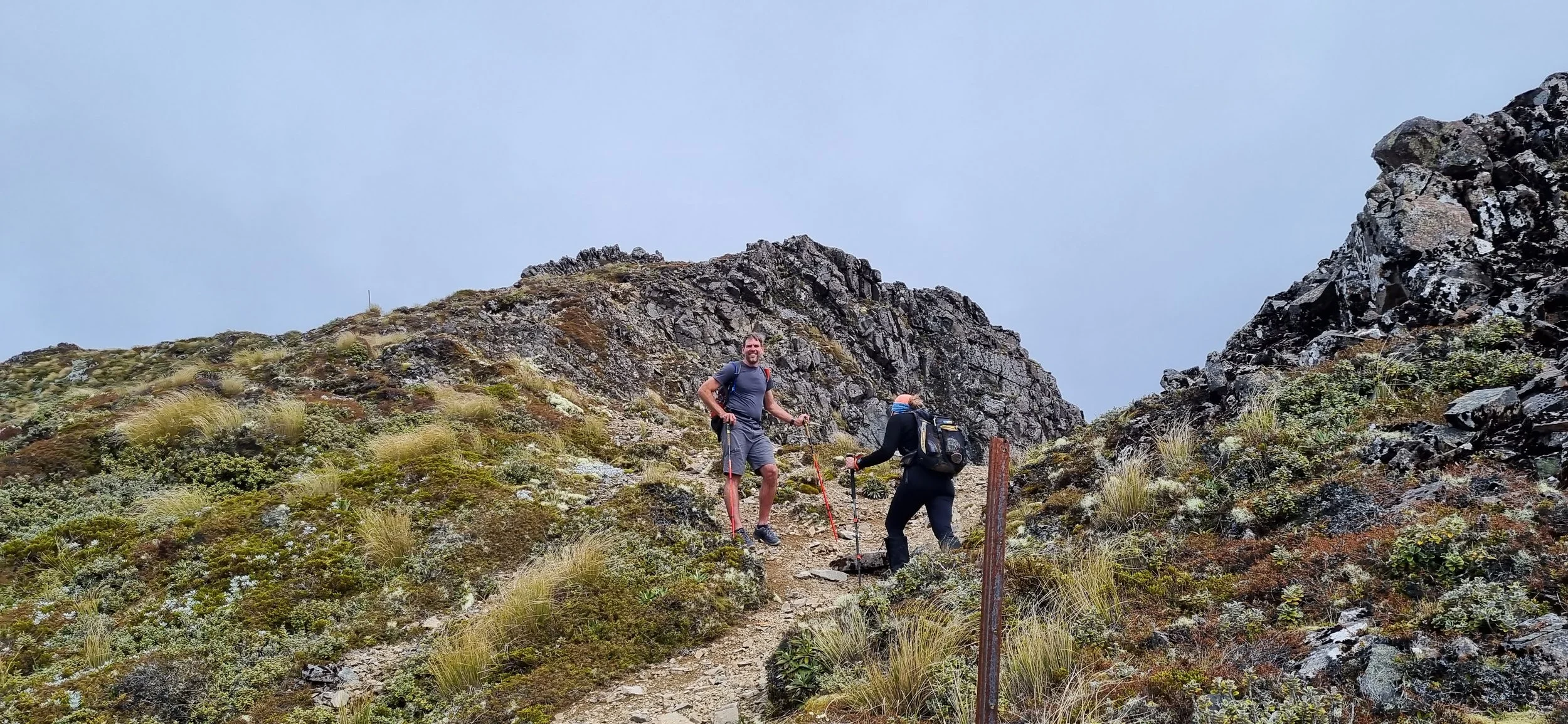
We dithered a while about which controls to go to. We had to climb Jolly Nose Hill (250m) and do a 50m abseil, plus pick up 80 points visiting any of the controls which were 10 or 20 points each. We headed off in the direction of the abseil, picking up a 20 pointer on the way in a gully. The bush was mostly easy going, but there was a big lantana patch which we could easily bypass by taking a track up the hill rather than following the gully. Having punched the control, we climbed out of the gully and did the steep climb to the summit of the hill. A marshall fitted us with helmets and harnesses and we were led through the scrub to the edge of a cliff. In turn we were clipped onto the rope and descended off into the darkness. The last 20m of the abseil were hanging in free space. When we had all descended, we next had to find our way back from the bottom of the cliff. This was quite rugged and we skirted the bottom of the cliff on steep slopes before eventually reaching the track we had come up on.

Our next control was down in another gully. We set off on a bearing from the track, and after realizing we were on an unmarked track (turned out to be a marked map correction), we headed north to the marked track and descended towards the control. The contours showed the control at around 80m, so we planned to hit the gully at around 100m by our altimeter then drop down to the flag. As we were making our final approach to the gully we hit an impenetrable patch of lantana. We dropped down the hill and skirted it to the gully, hitting the creek at around 80m by various altimeters (we had 3 between us!). Progress up the creek was blocked by an impenetrable wall, so we headed downstream thrashing through various thickets. When we got to 70m we were too low. I headed up the hill and stumbled onto an unmarked fire trail which looked like an extension of a short dead end trail on the map. A quick trip down the hill proved the case, and following back from the junction I crossed a minor gully then climbed to another minor gully. Hopefully this would lead to the creek junction with the flag, but on reaching the main creek we were back where we started. Further progress along the track was blocked by more lantana jungle. Even though the flag may have been less than 50m away (we had no way of knowing), it seemed easier to cut our losses and try our luck elsewhere. Fortunately there were plenty of options and we quickly bagged enough points. Coming back from the last control to the picnic area we made another diversion onto an unmarked track (also on the map corrections), before finally getting back to our bikes. A few lessons learned here!

A short ride along the now very muddy Tube Highway had us back at HQ.
The mud was bad enough that Gary's Time pedals clogged up totally. A bit of work for Andrew to do while we were on the next leg before we needed our bikes again... We had 20 mins allotted to repack and grab food before Brock drove us out to the drop point for the last leg. We power-napped in the back of Gary's car which unfortunately had a very uncomfortable seat. At one point Brock took a corner fairly hard and I woke with a start thinking he'd run off the road. I dozed off again only to be awoken by a bumpy wooden bridge, again convinced we'd left the road and woke everyone else up in my panic. We all had a good laugh, and were shortly at the drop point. We had 10 mins or so before we could leave (1 hour was allotted to prevent any need for unsafe driving). Two other teams, Mexicans and Mountain Designs had just left and we were in 7th place. At 5:40am we started the long trek of the final leg.

The first control was down the hill along a track at a creek junction.
We caught up to the Mexicans again here, and the sun had come up so we could put our torches away. Mountain Designs had apparently taken off up a gully somewhere on business of their own, so we didn't see them. The next control was up the creek - the Mexicans headed up the creek, but we took a track up the spur and then cut down to the creek about 2/3 of the way there. When we got to the creek the Mexicans were nearby, so there was no advantage either way. Past the control, we got into some very rugged gorge country as we headed further up the creek to the next control. Although only 1km, it took over 1 hour to get there. Teams who came through here in the dark reported glow-worms, bats, crayfish and even a giant python! We reached the control a little ahead of the Mexicans and charged off up the hill to the nearest track. Unfortunately it was overgrown, and we climbed higher and higher on the hill, knowing we'd missed it. Our altimeters clocked an extra 150m before we finally hit Big Nellie Rd and the descent to the next control at Waitui Falls.
From here we had to climb 400m in about 6km to Flat Rock Lookout. We passed the Mexicans again 2km up the road, just as we started the really steep climbing. Keeping the hammer down, it took us just under an hour to do the climb, and after briefly admiring the view over Lansdowne Valley we started the descent over about 6km to 50m, with the final 350m in under 2km taking us just under 20 mins! We were flying! At the bottom we found the NSW Stingers team. Christie was suffering very badly and in great pain. Another 6km of road bash with a few more hills into dairy country and finally we reached transtion at Hallam Vale Hall. Gary ran out of water here so we gave him what we could from our own supplies, but he was starting to suffer.

I'd been promised some cold pizza, and Andrew was as good as his word - it was delicious. We also found some sodium-encrusted shapes which went down well, and refilled our camelbaks before heading off down the valley on our bikes. We were now in 4th place, and determined to hold that to the end, but knowing that 2 teams behind us were strong paddlers, and an 18km paddle yet to come. Gary started complaining of calf cramps, and shortly had to stop. We tried massage and stretching, and he got going again, but for the rest of the 20km or so MTBing was forced to walk many of the hills and had to stop several times. He was slowly coming good though, and as we passed through the town of Kendall and across the river we were all feeling strong for the paddle.

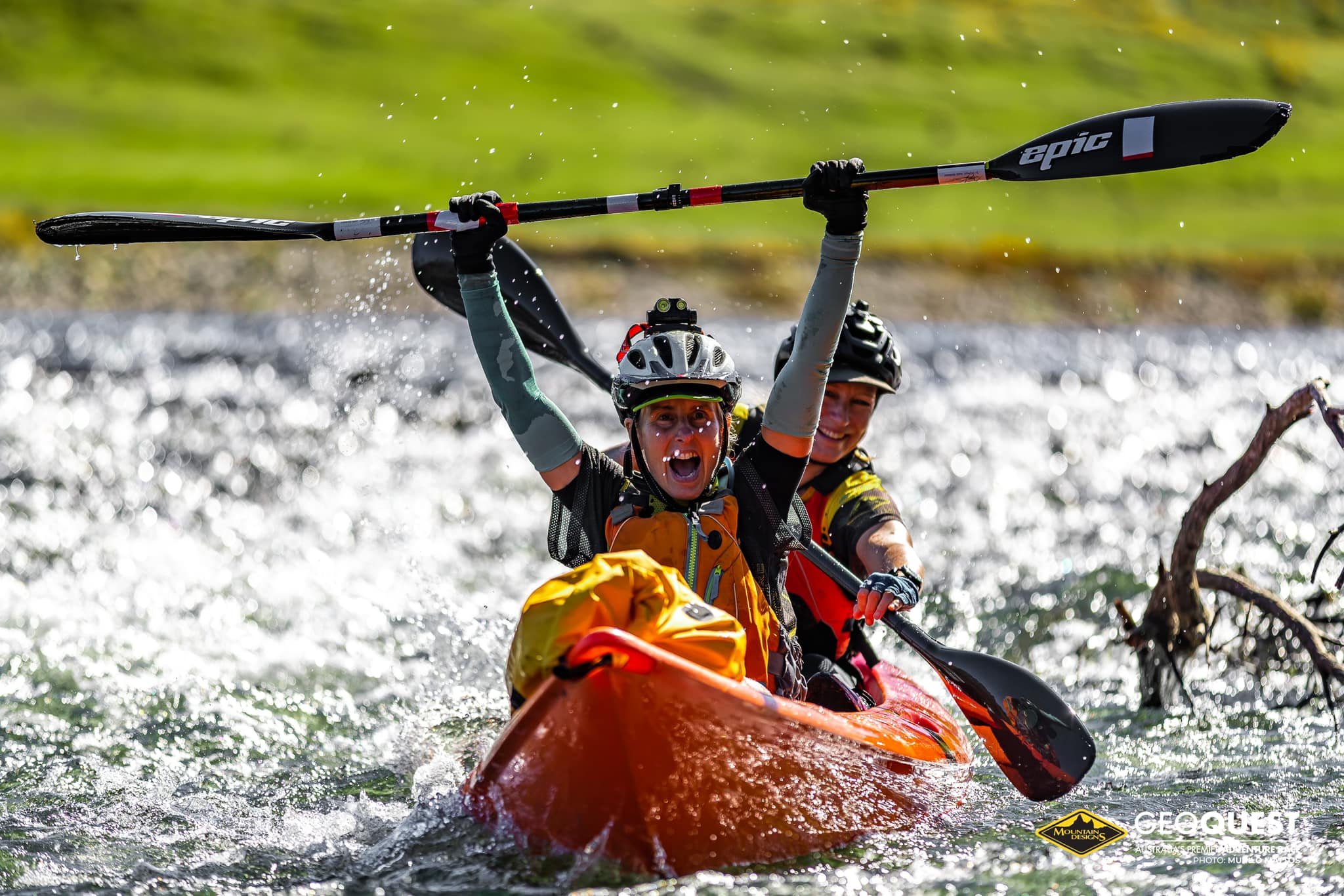
The transition was well laid out, and Judi and Halina the marshals gave us plenty of encouragement too. We put on shoes or booties since we knew there would be a portage and possibly some shallows to negotiate. We were soon on our way paddling as strongly as we could. We guessed we had
15-20 mins on the chasing teams, hopefully enough of a margin to hold them off to the start of the run. There were some headwinds on the first river sections, but we were soon passing under the highway then onto a sweeping bend. The control would be on the left bank, and I watched the landmarks pass by before finally the flag came into sight. Next was the portage, which turned out to be just 200m across a flat grassy paddock - perfect! Still no sign of our pursuers. Back onto the water and we searched across the broad reach for the buoys marking the channel entrance about 2km away. Once spotted we paddled hard again. A sand bank or two on the way didn't slow us much, and as we reached the channel we looked back and could see a chasing team carrying their boats. Into the channel we skirted oyster beds and picked our way past the channel markers, under the bridge and into the stronger tidal currents. For some reason I didn't pick that the current was running with us, so tried to stay out of it. Julie and Karl pulled away easily no matter how hard we paddled. Finally we wound our way into the main channel and tried to spot the transition. Eventually we spotted Brock and Andrew waving wildly from the shore and headed directly for them.

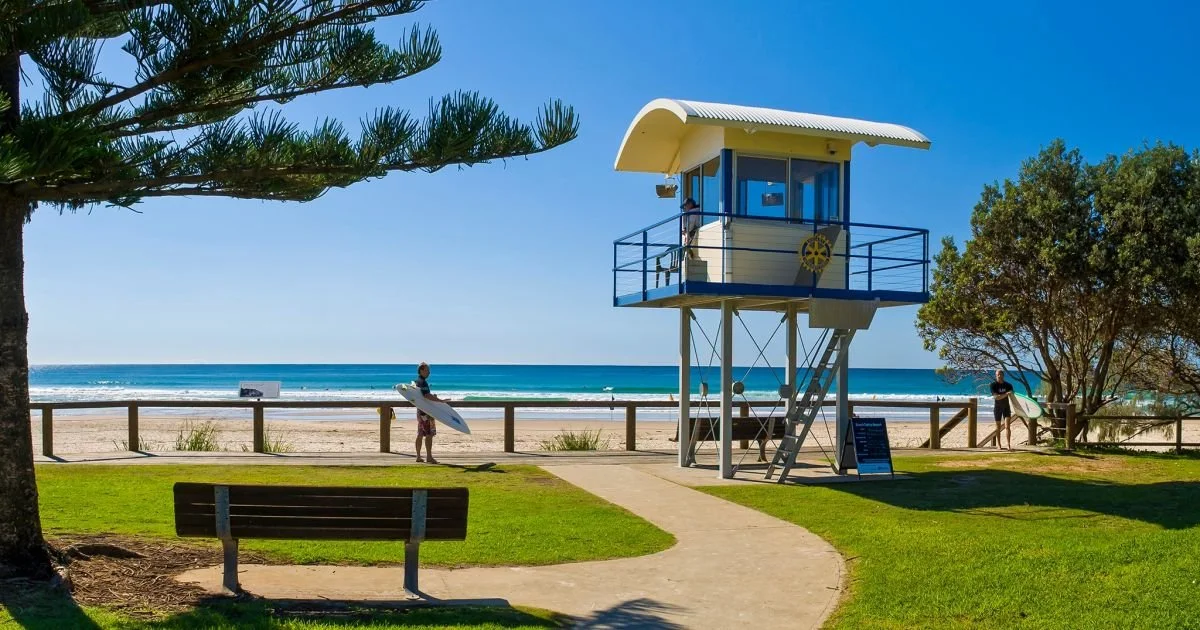
The transition was well set up again, and in less than 3 minutes we'd changed and charged off. We had about 9km to the finish, with a last control at the end of the breakwater along the sea wall. I ran ahead of the rest along the breakwater and punched the flag, then we headed back to hit the beach. We were about 6 min ahead of the Mexicans and could see then coming along the channel before we jumped onto the sands. We were holding a good pace though, and ran solidly along the firm sand, glancing back occasionally. The gap seemed quite big, and 4km after the breakwall we had climbed onto the top of Grants Head. The chasing team was about 1km behind still. We ran down the footpad back to sea level and negotiated several rocky sections before finally hitting the beach for the last 1km to the finish. It was in the bag now, and we held a steady pace to the finish, clocking 54 mins for the last 9km - not a bad pace after over 33 hours of continuous racing! 16 mins later the Mexicans finished - we'd pulled 10 mins out of them in the last section.
Even more satisying, we were only 4 hours behind team AROC, a truly world-class team.

Time to relax. Back to our cabin for a shower, then off to grab some takeaway. It was now dark and rain had started to fall - things were getting tough for the teams still battling it out on the course. By 9pm we had stuffed ourselves silly and were tucked up in bed. The next morning teams were still finishing as we sorted through our gear and started packing. A breakfast feast was laid on mid morning after the last team had crossed the line. Presnetations followed, then it was time to hit the road for the long haul back to Canberra and back to work the following morning.

tm14.jpg